California has been inflicted by a decade-long drought that’s brought an environmental reckoning within the state legislature. More green policies are being passed as the Golden State tries to combat climate change, but the biggest issue remains the decreasing water levels. However, some relief was felt with the record precipitation recorded in 2023 and into 2024.
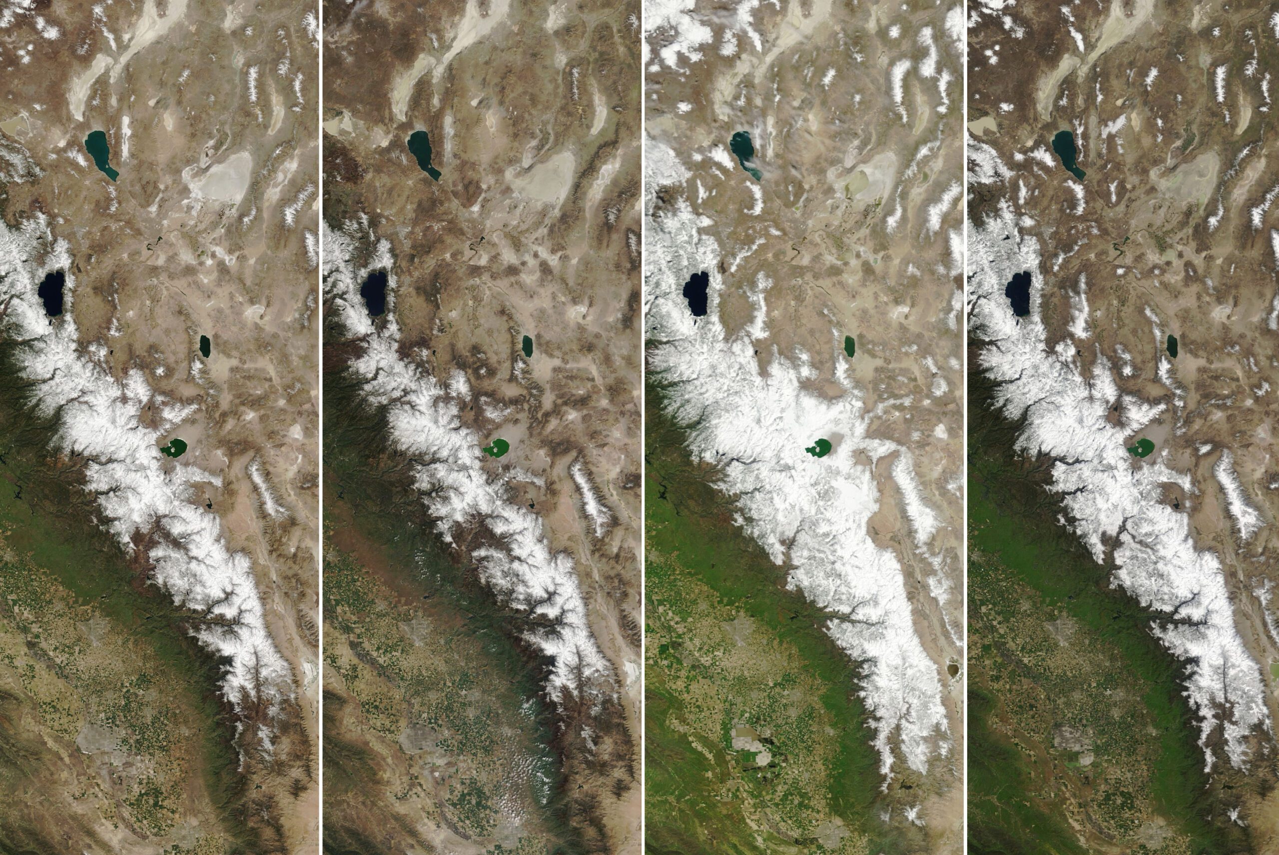
NASA satellite images show that California is bouncing back. Central and northern regions of the state showed a lot more green. Compared to images from just a year ago, these paint a very optimistic picture of the state of the drought.
The National Integrated Drought Information Systems (NIDIS) reported that only 2.7% of California looked drier than usual, and those were the border regions near Arizona, Nevada, and Oregon.
Even then, the drought database didn’t classify them as being in one.
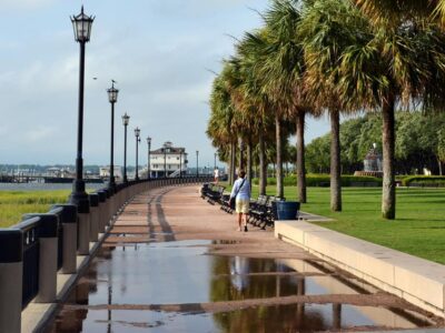
The Los Angeles Times reported the news and included an interactive graphic showing the vegetation difference. You can slide back and forth between satellite images from November 2023 and March 2024. Southern California looks starkly greener after being incredibly brown for years.
As of March 15, the Sierra Nevadas are white-capped after record snowfall this year. Northern Sierra reached nearly 118% of historical snowfall levels. Meanwhile, Central Sierra has 101% and Southern Sierra around 95%.

Photo Courtesy NASA
The California Department of Water Resources (DWR), which falls under the California Natural Resources Agency, is thrilled that wet weather is coming back in full swing. In the Water Year 2023 report, DWR outlined how three driest years (2020–2022) were followed by one of the wettest. California experienced approximately 141% of statewide precipitation and 237% of the April 1 Sierra-Cascade snowpack. Scientists compared 2023’s precipitation to 30-year averages provided by the National Oceanic and Atmospheric Administration (NOAA).
“The water year began with continuation of the dry conditions that had characterized the three prior drought years, but a pattern shift occurred in late December with the arrival of an exceptionally strong atmospheric river storm,” the report explained. “The remainder of the wet season was characterized by an abundance of atmospheric river storms in stark contrast to their relative paucity in the prior dry years.”
In Water Year 2023, Lake Mead and Lake Powell got a much-needed replenishment amid water rationing for neighboring states like New Mexico and Arizona. The DWR report said both human-made lakes saw water storage increase by 38% and 34%, respectively.
Some areas, particularly in Southern California, saw groundwater levels return to normal; however, much of Central California still faces low levels.
As for this year’s snowpack, NASA said the numbers didn’t jump above 100% until March 2024. When they viewed the Sierra Nevadas on the Terra and Aqua satellites on Feb. 1, the mountains were only 37–53% of normal. Later in the month, they were at 65–78% of normal, and in March, all expectations had been shattered.
“The series of decent-sized storms toward the end of winter turned what initially looked to be a dry winter into one that was surprisingly average,” McKenzie Skiles, associate professor of geography and snow scientist at the University of Utah, said in a NASA Earth Observatory article.
The news is a huge win for Californians, but caution must still be exercised. The drought isn’t over despite a lengthy wet period. The weather pattern could revert to drier conditions, and one prolonged wet spell isn’t enough to make up for 10-plus years without steady rain or snow.
The real risk now is natural disasters caused by extreme wet weather. Floods and landslides occurred in several areas that experienced more rain and snowmelt. Central California, mainly in Monterey County, bore the brunt of the flooding.
Two tropical storms hit Southern California in Water Years 2022 and 2023. In 2022, Tropical Storm Kay was the closest to the state from the Pacific Ocean in 50 years and brought flash floods. In 2023, Tropical Storm Hilary made landfall over Baja California and even caused the first National Hurricane Center warning to be issued for California.

Photo Courtesy Jim Ross/NASA
According to NIDIS, this March was the 40th wettest one on record. ABC News reported that some residential areas, like Santa Barbara, even saw a 300% increase in average precipitation between the early months of 2024 and now.
This weather activity contributed to increased groundwater and reservoir storage in Trinity Lake but not enough to fully recover 2019 water levels, the last time normal water supplies were measured.
Fear not, though, Californians! You will still have enough water to carry over into Water Year 2024, even if there are more dry conditions.
California is showing much better signs of a fading drought. Some areas near the Oregon and Arizona borders show signs of abnormally dry conditions, but the rest of the state looks healthy. That is good news for a state that produces much of the country’s food supply.
Some residents might bemoan the increased rainfall, but it has been beneficial to the state. The Southwest needed a lifeline as local water supplies dwindled, and more were drawn for the Colorado River, Lake Powell, and Lake Mead. Water security remains an issue, but consumption should become less problematic if the rain keeps coming.